Days 5/7 Hampton Court to Marlow 18-20 April 2025
All images for this section are on:
Day 5: Hampton Court to Walton Bridge (6 miles)
The next three days have been planned for some time. Sadly, Matt has injured his leg and is unable to join us. Be good if he can catch up the 37 miles we hope to walk but, given his work commitments, perhaps unlikely. Dave and I will carry the flag to the end, whatever.
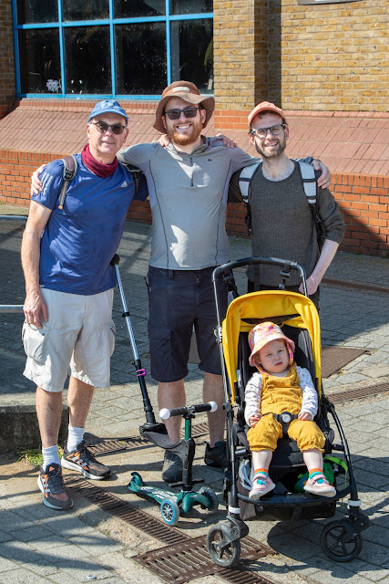
So today's line up is: Dave and me, Paul, Mikey (Dave's brother-in-law), Freya and Evie. We aim for 6-7 miles but the vagaries of including a 3 year old and 1 year old make this an uncertain goal.
.jpeg) |
| At Hampton Court |
The Cicerone guide is excellent for the Thames Path as it has far more history per mile than any other Trail. Indeed, one problem of reading it is actually locating some of the interesting places highlighted. An example today is Truss's Island, named after a forefather of the unfortunate Liz Truss. We pass by without realising, despite my efforts at finding it en route.
The start is busy, as would be expected on a Bank Holiday. The girls are lively and inclined to run or walk in any direction except westwards.
.jpeg) |
| Freya admiring the geese and ducks with Uncle Paul |
.jpeg) |
| Evie clinging on to Daddy |
The weather is perfect for walking: intermittent sun with temperatures in low teens. Wind is cooling at times.
This section is relatively devoid of notable sights. Bushy Park is evident on northern side of the river. The Trail coincides with route 4 National Cycle Trail for the entire distance, and is all hard surface as a result.
Rob joins us for a few miles on his bike, and we stop at a pub briefly before Walton on Thames
.jpeg) |
| Church at Hampton |
We walked unknowingly along a stretch known as Platt's Eyot where torpedo boats were built. Amazing. Even Cicerone finds it difficult to get excited by this short section.
We finish early afternoon as girls are tired. The serious walking starts tomorrow...
|
Hampton Court to Walton Bridge |
Day |
Cumulative |
|
Miles walked |
6.0 |
47.0 |
|
Hours |
2.5 |
19.5 |
|
Ascent (metres) |
10 |
80.0 |
Day 6: Walton Bridge to Windsor (15 miles)
Freya and Evie have gone with Uncle Mikey and Mum Alice to see Grandma in Cambridgeshire, so it is Paul, Dave and me today, plus Dominic who is joining us for the day. He reckons he and Jackie walked what is now the Thames Path back in the 1980s, a decade or so before it became a National Trail in 1996 .
The weather is chilly wind to start with, though gradually becomes sunny and warm during the day. Having taken a Bolt taxi to Walton Bridge from Dave's home in Kennington (Paul and I stayed in a nearby residence courtesy of Booking. com) we meet Dominic and are under way at 1015. We are carrying more than day sack as Paul and I had to bring clothes and wash bag supplies to last three days. 15 miles on hard surface could be challenging.
We pass D' Oyly Carte Island and take Shepperton Ferry for our first experience on Northern side of Thames since Hampton Court. I think this is the only ferry we take on the entire Trail.
We continue to Chertsey, with a brief stop at Laleham. We begin to realise we are fortunate that the weather has been so dry recently. Some sections like below are narrow and would be muddy in wet weather. The recent dry weather has baked the mud hard and going is consequentially easy, though I fond by the end of the day that the continuous hard surface walking coupled with heavier than normal rucksack makes my back and leg muscles ache.
.jpeg) |
| Path narrows here and is one the first sections that would be muddy in bad weather |
We stop in Staines for coffee and cake, just under halfway. The town has one of three statues commemorating the swan masters (more recently known as Swan Marker) of River Thames. We cross to the southern side of the river.
Leaving Staines, we encounter the first diversion, caused by a closed bridge over a culvert. It is impossible to ignore and the inadequate signage means we must walk nearly an extra mile to retrace steps and walk along the A308 to a point just past the underpass for the M25.
It is about 3 miles from Staines to Runnymede, one of the iconic landmarks on the Trail. I came here a long time ago with Sue, and remember nothing of it. The river is particularly lovely here, with an avenue of willow trees making for my favourite image of Thames Path so far:
.jpeg) |
| Runnymede |
It is very warm now. We divert a short distance from the Trail to view the Magna Carta Monument and eat our sandwich lunch nearby. There is a plaque to celebrate that the Queen and many dignitaries came to the site to celebrate the 800th anniversary of the signing of the Magna Carta.
We make good time on an attractive section of the Trail towards Datchet.
We cross the river twice more, the first to the north on Albert Bridge, the second to the south over the Victoria Bridge. Both were designed by Prince Albert in 1850s. In between, there is a road section through Datchet.
The final section on the southern side is around a meander through Home Park. For first time, on the Trail so far we see few people and it feels quite rural. We are tiring as the walk has been longer then anticipated due to the diversion.
Dominic leaves us for a train home to Kingston. Dave, Paul and I have an unwelcome walk of nearly a mile to Holiday Inn Express. The official distance is 15 miles but my watch tells me we have added 1.5 miles.
Though tiring, this is easily the best day so far. There is variety with some rural scenery as well as suburbia; some amazing residences to gawp at; towns and villages; lots happening on the river (we encounter competitors in the annual Devizes to Westminster canoe race at one lock); and Runnymede. As with any walk, the weather and walking conditions help make it a classic day.
|
Day 7: Windsor to Marlow (15 miles)
An early start for Matt, Paul and me today sees us leave the Holiday Inn Express at 0750. The Holiday Inn Express was comfortable but expensive at £382 for two rooms. It is Easter and it is Windsor, so perhaps should not be surprised; the rooms were only a little cheaper for Saturday night a week later.
It is 20 minutes and nearly a mile distance, to reach the bridge where we head over to north side of the river again to the grassy area of The Brocas meadow.
Continuing on the northern side of the Thames, we pass under a Brunel designed railway bridge and the bridge beneath the Windsor relief road. The remaining four miles is quiet; we are early and see only the occasional runner and dog walker. We pass St Mary's Boveney Church that was mentioned in 1266, and is now under the auspices of Friends of Friendless Churches.
Continuing on the northern side of the Thames, we pass under a Brunel designed railway bridge and the bridge beneath the Windsor relief road.
The remaining four miles to Maidenhead pass alongside Dorney Lake Park Rowing Centre where the 2012 Olympic rowing and canoeing events were held. We pass some very expensive homes on the opposite bank.
.jpg) |
| Some impressive real estate on southern bank of the Thames |
Passing Bray, the Trail passes under the M4 and another Brunel inspired bridge - the Maidenhead Railway Bridge - then cross to southern side where we stop for a coffee and cake break at a cafe in a park.
After a chilly start, it is rapidly warming up as we pass Boulter's Lock, the longest and deepest on the Thames.
.jpg) |
| Boulter's Lock |
Leaving Maidenhead, we walk 2k with fields on our left and wooded area on right where the river rises steeply. Eventually we arrive opposite the grounds of Cliveden, home once of William Waldorf Astor whose niece Nancy Astor was the first female MP and Cliveden's hostess, entertaining many luminaries. The property is now in hands of National Trust.
The path turns sharp left and passes alongside the Cookham Commons, a wetland area also owned by National Trust.
The Trail leaves the river briefly as it passes through Cookham. The church gardens are beautiful.
Rejoining the river, The Trail leads to Bourne End where a bridge crossing to north bank over the Bourne End footbridge alongside the railway bridge. The footbridge was added in 1993 ahead of the Thames Path opening, and saves a long walk over Winter Hill. After a brief stop, we continue through wide grassy meadows to Marlow where we follow the Trail through some narrow paths to our end point for this stage.
This a pleasant section, with variety and easy going. We are lucky that the weather has been so dry recently, else we would have been trying to avoid several muddy sections. We hope to return for a couple of day walks in the summer; be good to get over halfway.
.jpg) |
| End of the walk in Marlow |
|
Windsor to Marlow |
Day |
Cumulative |
|
Miles walked |
15.0 |
77.0 |
|
Hours |
5.5 |
31.0 |
|
Ascent (metres) |
20 |
145.0 |
.jpeg)
.jpeg)
.jpeg)
.jpg)
.jpeg)
.jpg)
.jpg)
.jpg)
.jpg)

.jpg)
Comments
Post a Comment